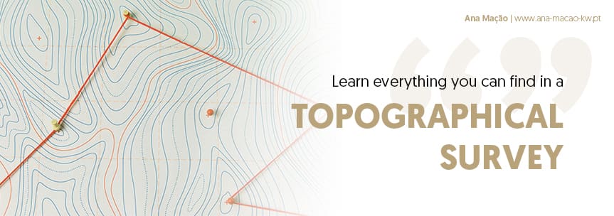
Topographic Survey
Topographic surveying consists of mapping the surface of a piece of land , through measurements carried out by a surveyor, to draw up a topographic plan that highlights variations in relief and other geographical features. It is a fundamental element and is present in the different phases of a construction: in the design, execution and supervision of the work.
(Top▲) What is a topographic survey?
The topographic survey consists of the representation - planimetric or altimetric - on a map or plan of notable points, as well as geographical features and other prominent details, based on precision measurements (which include optical and GPS equipment) carried out on a piece of land.

There are 3 main types of topographic surveys that can be used to measure the elements and characteristics of a terrain: Planimetric, Altimetric and Planialtimetric . The first refers to measurements on a plane, while the second takes measurements vertically. The union of these two results in the planialtimetric survey, one of the most used methods and the one that allows for more complete mapping:
1 - Planimetric Survey
The planimetric topographic survey, also called Planimetry, is characterized by the measurement of the horizontal projections that define an area. It is carried out by measuring distances and angles between points on the ground, and with the information collected, a topographic plan is produced, which is a scaled representation of the land on a horizontal plane.
This type of survey is mainly used for: demarcating land, implementing construction projects, surveying areas for agricultural or forestry purposes and mapping natural and artificial elements.
2 - Elevation Survey
Elevation survey consists of measuring the difference in height between points on a piece of land . This method, also called altimetry, records the degree of slope of a terrain, such as valleys, hills, embankments, slopes, etc. Contours are plan representations of points on land that have the same height. By connecting them using lines, contour lines are obtained, which represent the variations in relief. The contour lines do not take into account houses, walls or other non-natural constructions.
Civil engineering projects that need to calculate the volume of land for excavation or embankment, to map areas at risk of flooding or landslides, or road and dam projects, use this type of topographic survey.
3 - Planialtimetric survey
The planimetric survey consists of the union between the planimetric and altimetric surveys. This method allows recording both the measurement of horizontal projections and differences in height of the terrain relief. In other words, it generates a more complete mapping.
This survey is necessary in cases where a detailed mapping of the conditions of a land is required, such as construction projects, infrastructure and mapping projects, etc.
Other types of topographic surveys
In addition to the three main types of topographic surveys, there are other types of topographic surveys that can be carried out for specific purposes. Some examples include:
- Georeferenced Survey: In reality, this is not an independent type, but rather a complementary technique that can be applied to any of the types described, and which aims to assign geographic coordinates to points on the ground, using a global reference system, such as the Universal Geodetic Coordinate System (WGS84). This technique adds greater data accuracy and reliability, integration with other geographic information systems and ease of data visualization and analysis.
- Cadastral Topographic Survey: This type of survey is used to determine the position, shape and size of a land, as well as the identification of its owners and neighbors. Used in the cadastral plan, it is useful in real estate transactions, to regularize the status of a land, in the case of division or rectification of a land, or to carry out construction works.
- Bathymetric Topographic Survey: This type of survey is used to determine the depth of water in bodies of water, as well as the relief of the bottom, identifying the presence of depressions, elevations, obstacles and other relevant elements. It is used to carry out hydrographic studies that aim to determine the safe navigability conditions of a river or other body of water, to monitor its erosion and sedimentation, etc.
- Archaeological Topographic Survey: This type of survey is used to map archaeological sites. It is a technical-scientific procedure that aims to document and record the archaeological remains present in a given location. It is carried out by a licensed archaeologist, based on specific standards and procedures.
The choice of the type of topographic survey will depend on the specific objectives of each project.
(Top▲) What does a topographic survey contain?
According to each surveyor, the information may be more or less detailed, as well as the type of format delivered (essentially digital, but can even be 3D). Some of the information to be provided will be:
- Land boundaries (walls, fences, boundary stones, etc.);
- Elevations and contour lines that show the morphology of the terrain;
- Location of buildings and neighboring constructions (when these are nearby);
- Location of infrastructures (water, sewage, stormwater, electricity, telephones, gas, etc.) and respective threshold levels;
- Location of accesses (roads, paths, etc.);
- Location of the main tree species (especially if there are protected species, such as cork oak);
- Geographic coordinates, if the topographic survey was contracted with this requirement.
(Top▲)What is a topographic survey used for?

Topographic survey aims to map the surface of a land and compile a set of data that will later be used to create plans and profiles, graphic representations of the terrain's characteristics.
It is an essential element in the preparation and execution of any construction project, it is essential for registering the land at the registry office, for applying for municipal licensing, for carrying out earthworks or land removal, control and execution of the work, inspection work , etc.
In the case of building a house, the topographic survey is usually the first step for the architect to develop an architectural project. Therefore, any buyer of a plot of land must request it even before purchasing it. Not only because carrying it out represents an additional cost, but because in this way it is possible to detect possible discrepancies between the areas registered in the Permanent Certificate of the Land Registry or in the Land Registry and the reality revealed by the topographic survey.
This survey is essential for registering the property with a registry office, for municipal licensing of civil construction works and, later, for the execution of works, such as earthworks or land removal. In short, Topographic Survey is used to:
- Determine the limits and areas of urban and rural land;
- Carry out the altimetric survey in order to provide the designer and the person responsible for the work with data about the elevations and depressions of the terrain;
- Facilitate the registration and registration of land for legal purposes;
- Prepare road or canal and river profiles;
- Obtain cross-sections of volumes, such as terrain elevations and others;
- Measure volumes;
- Determine the volume of landfills.
(Top▲) Who can carry out a topographic survey?
A professional qualified to produce a topographic survey is called a topographer . He is the one who will define the type of topographic survey to be carried out and will carry out the necessary measurements for its preparation, using specialized measuring equipment.
In Portugal, only professionals certified and authorized by the Directorate-General for Territory (DGT) can carry out topographic surveys. These professionals are:
1. Surveyors:
- Topographic Technicians have specific training in topography and are qualified to carry out all types of topographic surveys.
- They are required to have professional civil liability insurance.
- They can be found through the Order of Engineers or the Portuguese Association of Surveyors.
2. Engineers:
- Civil Engineers, Agricultural Engineers and Architects with a specialty in Geodesy and Topography can also carry out topographic surveys.
- They must be registered with the respective professional association.
(Top▲) How much does a topographic survey cost?

The cost of a topographic survey varies depending on the entity or surveyor, the area to be mapped, the geometry of the terrain, the estimated time, as well as the region of the country.
It is recommended to request more than one quote to be able to choose the best price/quality ratio. However, it is common to find technicians who charge amounts of around €200 for a 450m² plot, and between €300 and €400 for larger plots, up to 1000 m², although there are those who offer more affordable quotes.
However, the type of topographic survey can also influence. Here are some reference values (taken from Zaask , for a plot of land with an area of 500 m²):
- Altimetric and Planimetric Survey - The cost is around €160 ;
- Planialtimetric Survey - The cost is around €220;
- Georeferenced Survey - The cost is around €450.
(Top▲) Frequently asked questions about Topographic Survey

These are some of the most frequently asked questions about Topographic Survey:
1. What is a topographic survey?
A topographic survey is a set of techniques and methods that aim to determine the shape, position and dimensions of a piece of land. Through specific instruments, such as: Total station, Topographic level, GPS, drones, etc., precise data are collected on the Earth's surface, allowing the creation of detailed plans and maps.
What are the types of topographic survey?
There are several types of topographic surveys, each with a specific objective. Among the most common are:
- Planimetric survey: determines the horizontal position of points on the ground.
- Elevation survey: determines the height of points on the ground.
- Cadastral topographic survey: demarcates the boundaries of properties and land.
- Bathymetric topographic survey: maps the bottom of bodies of water.
- Topographic survey with drones: uses drones to collect data, allowing greater speed and precision.
What is a topographic survey for?
Topographic surveys are used in several areas, such as:
- Civil engineering: construction projects, urbanization, subdivisions, etc.
- Architecture: projects of houses, buildings, etc.
- Agronomy: irrigation projects, drainage, etc.
- Environment: environmental impact studies, etc.
- Mining: mine planning and mineral extraction.
How much does a topographic survey cost?
The cost of a topographic survey varies depending on several factors, such as: Size of the area to be surveyed: larger areas require more time and resources. Survey complexity: more complex surveys, such as bathymetric surveys, require specialized equipment and labor. Location of the area: areas that are difficult to access can make the service more expensive. But the cost, in the most common situations, can vary between €160 and €600.
Who can carry out a topographic survey?
A topographic survey must be carried out by a qualified professional, such as a cartographer engineer or a topography technician, as long as they are authorized by the General Directorate of the Territory (DGT). These professionals have the knowledge and instruments necessary to guarantee the accuracy and reliability of the data collected.
How long does it take to carry out a topographic survey?
The time required to carry out a topographic survey depends on several factors, such as those mentioned above. In general, surveys of small and less complex areas can be carried out in a single day. Surveys of larger and more complex areas can take weeks or even months.
What do I need to do to request a topographic survey?
To request a topographic survey, you need to contact a company specializing in topography. The company will assess your needs and provide a quote for the service.
What documents are needed to request a topographic survey?
The documents required to request a topographic survey may vary depending on the company and the type of survey. However, some documents are generally required, such as:
- Property ownership certificate: if the survey is carried out on private land.
- Property plan: if available.
- Construction projects: if any.
What are the risks of a poorly done topographic survey?
A poorly done topographic survey can generate several problems, such as
- Errors in the plan or map: these can lead to problems in the construction of works, for example.
- Incorrect land delimitation: can generate conflicts with neighbors.
- Loss of financial resources: investments in projects based on incorrect data may be lost.
How to choose a topography company?
When choosing a topography company, it is important to consider some factors, such as:
- Company experience: look for companies with experience in the area in which you need the service.
- Qualification of professionals: make sure that the company has qualified professionals with training in topography.
- Company reputation: research the company's reputation in the market and read reviews from other customers.
Important Note: The information in this glossary is for informational purposes only. For proper advice on legal or tax matters, consultation with a duly authorized lawyer, notary, solicitor, or accountant is essential.
Your next step in the real estate market
Whether you want to sell your property for the maximum value or find the ideal home, count on my experience as a Top Producer consultant at KW Portugal. Talk to me without obligation. Start today with a simple contact.
Contact Me Today
Related articles


Follow me
on Social Media